Bike tour · Stubaital
MTB Pfarrachalm
Starting point: Freizeitzentrum Stubay, Neustift
7
km
763
Hm ↑
2 h
Walking time
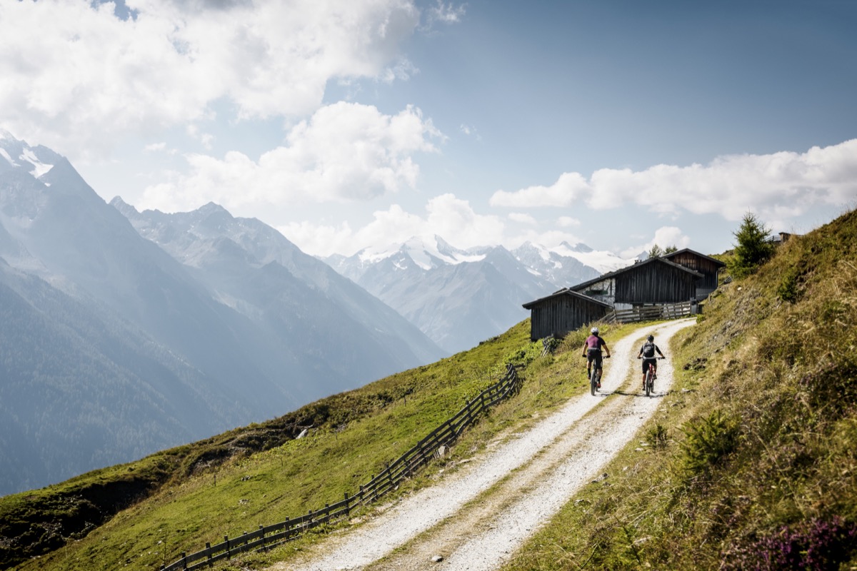
The MTB Pfarrachalm is a short but intense tour – and that’s exactly what makes it interesting. On only 7 kilometers of trail length, one overcomes 763 meters of altitude. This means: steep ramps, tight curves, and a real workout that puts the tour into the middle difficulty category despite its brevity. Up top, the Pfarrachalm awaits with one of the most beautiful views of Neustift and the middle Stubaital.
Why this tour?
The Pfarrachalm is one of the oldest and most well-known Alms in the municipality of Neustift – with a long history as a grazing and economic Alm. Today, the Alm hut is a popular excursion destination for hikers and bikers alike. The combination of accessible distance and real challenge makes the tour ideal for those who don’t want to be on the go all day but still want to achieve something.
The start at the Freizeitzentrum Stubay is practical: parking, sanitary facilities, and a café are available. Those who want to cool off afterwards are just a few minutes away from the outdoor pool.
Trail description
Start Freizeitzentrum Stubay (ca. 990 m): From the parking lot, follow the path northwards, to the ridge, where the ascent to the Pfarrachalm begins. The first meters on asphalt, then gravel.
Steeper Ascent (ca. km 0.5–4): Here, the tour shows its teeth. The forest road rises on part of the route with a slope of up to 20% – that’s also not a walk in the park for E-Bikes. The technical aspects of the ramps are uncomplicated (no rocks, no single trail), but the physical demands of the combination of length and slope are significant.
Middle Section (ca. km 4–5.5): The slope becomes a bit more moderate, the forest lightens up. Good opportunity to catch one’s breath and enjoy the view, which now opens up to the south over the Stubaital.
Pfarrachalm (ca. km 5.5–7, ca. 1,750 m): The destination. The Alm lies on a slope plateau with a free view of Neustift, the villages in the valley, and the mountain chain behind. On clear days, you can see far into the Inntal. The hut is inhabited and offers Tyrolean mountain snacks.
Descent: Down the ascent route to the starting point. The steep sections require good braking skills – fingers on the brakes, body weight shifted backwards.
Refueling possibilities
| Location | Location | Speciality |
|---|---|---|
| Pfarrachalm | km 7 (destination) | Inhabited, Tyrolean mountain snacks |
| Freizeitzentrum Stubay | Start/Destination | Café and snacks |
Requirements
- Condition: Middle to high – the high altitude density demands even trained bikers
- Technique: No obstacles, but steep ramps require bike stability
- Bike: Mountain bike or E-Bike; trekking bike only for very fit riders
- Brakes: Well-maintained brakes – the descent is accordingly steep
Practical Tips
- E-Bike Battery: High energy consumption due to high slope – fully load
- Warm-up: Short loop ride on the valley bike path before starting the ascent
- Best time: June to October; in May, there may still be snow above
- Dogs: Suitable, fit, and sure-footed – the ascent is not a stroll for dogs either
The MTB Pfarrachalm is the perfect tour for those with little time but a great appetite for altitude – short, steep, rewarding.
Route map
Frequently asked questions about MTB Pfarrachalm
- How difficult is MTB Pfarrachalm?
- MTB Pfarrachalm is rated "Moderate". The route has 763 metres of elevation gain.
- How long is MTB Pfarrachalm?
- 7 km. Hiking time: approx. 2 hours.
- Are dogs allowed on MTB Pfarrachalm?
- Dogs are not allowed or not recommended on this trail.
Questions about this route?
The AI Guide knows all details about this trail