Hiking route · Stubaital
Mutterberger See
Starting point: Mutterberg, Stubaier Gletscher Parkhaus
11.85
km
831
Hm ↑
6.25 h
Walking time
- Dogs allowed
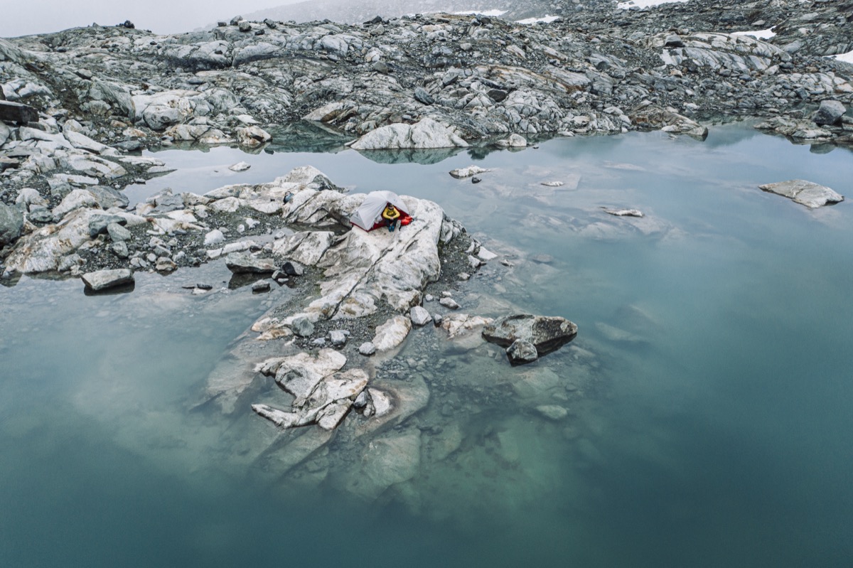
Mutterberger See (2,476 m) is one of the serene highlights at the end of the Stubaital valley. High up, almost on glacier level, the Alpine lake lies nestled in a vast kar – with a direct view of the ice masses of the Stubaier Gletscher. The hike to it is long and demanding, but every height gain is worth it.
Why Mutterberger See?
There are destinations that you must have seen. Mutterberger See belongs to them. The deep turquoise of the water, the surrounding rocks, the glacier in the background – the picture presented here is the Stubaital in its purest form.
Dogs are allowed – a rare privilege for a high mountain tour of this height.
Route Description
Start Mutterberg (ca. 1,750 m): From the Gletscherparkhaus towards Wilde Wasser Weg first, then branching off towards Mutterberger See.
Ascent through the kar (ca. 1,800–2,200 m): The path follows the valley’s headwaters upwards. Increasingly rocky but well-marked.
Steeper passage (ca. 2,200–2,400 m): The path becomes steeper, occasional safety measures help at exposed points. No climbing terrain, but sure-footedness required.
Mutterberger See (2,476 m): The lake opens up without a hitch. Rookery at the water’s edge, glacier views, silence.
Return
Same path back to Mutterberg. Total walking time with a break around 6–7 hours.
Requirements
- Good physical condition required (over 800 hm, long terrain)
- Sure-footedness in the upper section
- Fitted hiking shoes with profile
- Dogs allowed, but they must be sure-footed
- Not suitable for wet conditions or poor visibility
Tips
- Best time: July to September – the lake is still partially ice-covered in early summer
- Provisions: No hut at the lake – sufficient provisions should be taken
- Combination: Visit the Grawa Waterfall on the way back (short detour)
- Parking: Gletscherparkhaus Mutterberg – payable
The Mutterberger See is the serene end of a long valley hike – a destination that you leave with the feeling of having really been at the top.
Route map
Frequently asked questions about Mutterberger See
- How difficult is Mutterberger See?
- Mutterberger See is rated "Difficult". The route has 831 metres of elevation gain.
- How long is Mutterberger See?
- 11.85 km. Hiking time: approx. 6.25 hours.
- Are dogs allowed on Mutterberger See?
- Yes, this trail is dog-friendly.
Questions about this route?
The AI Guide knows all details about this trail