Hiking route · Stubaital
Rinnensee
Starting point: Schlick 2000, Bergstation (with cable car)
10.8
km
1200
Hm ↑
8 h
Walking time
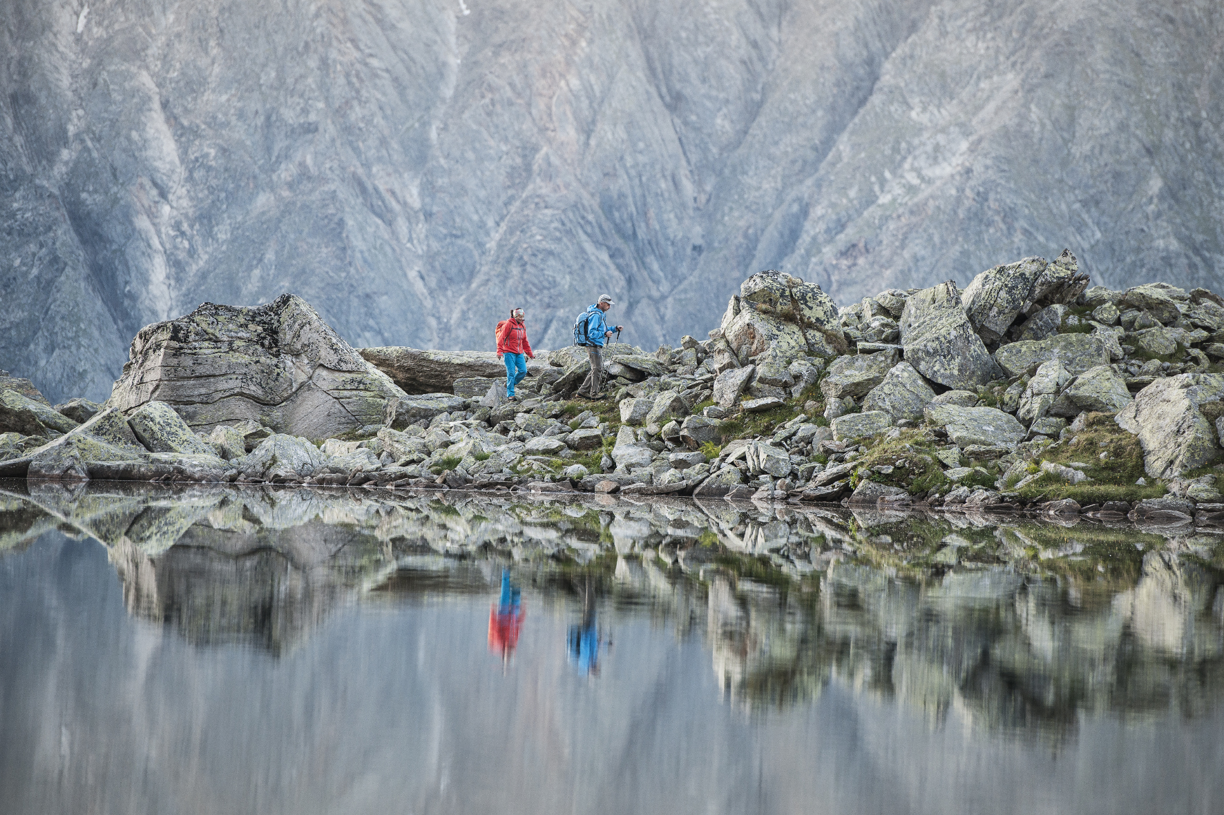
The Rinnensee (2,520 m) is one of the most secluded high-altitude lakes in the Schlick catchment area. The tour begins comfortably with the Schlick 2000 cable car – but what comes next is tough: 1,200 meters of altitude gain over the Schlicker Kar and further up into the high-alpine zone. No hut, no shortcut, no crowds.
Why the Rinnensee?
Exactly because it’s not easily accessible. The Rinnensee lies in a valley far above the tree line, surrounded by rock and snow. Who makes it here finds quiet, clear water and a high-alpine landscape, as original as it gets.
Route Description
Schlick 2000 Cable Car Station (1,980 m): Up the mountain by cable car, then immediately on to the signposted path towards the Schlicker Kar.
Schlicker Alm (approx. 2,060 m): Brief opportunity to stop for a snack before the long ascent. Last inhabited station.
Schlicker Kar (2,200–2,700 m): Long, grueling climb through the valley. The path becomes increasingly rocky and steep. Markings must be carefully observed.
High Plateau / Rinnensee (2,520 m): After the final steep section, the high plateau opens up with the lake. Solitude, expanse, quiet.
Requirements
- Excellent physical condition required (1,200 meters of altitude gain despite cable car)
- Good balance necessary for the upper valley
- No fear of heights on exposed sections
- No dogs – nature reserve and too demanding terrain
- Weather awareness: no shelter above the alm
Tips
- Cable Car: Check Schlick 2000 operating hours in summer – early start recommended
- Provisions: Nothing available from the Schlicker Alm onwards – bring sufficient water and food
- Best Time: July to September
- Alternative Destination: Those with less time turn back at the Schlicker Alm – still worth it
The Rinnensee is a tour for experienced hikers seeking solitude and authentic high-alpine atmosphere. They have to earn it – but it’s worth it.
Route map
Frequently asked questions about Rinnensee
- How difficult is Rinnensee?
- Rinnensee is rated "Difficult". The route has 1200 metres of elevation gain.
- How long is Rinnensee?
- 10.8 km. Hiking time: approx. 8 hours.
- Are dogs allowed on Rinnensee?
- Dogs are not allowed or not recommended on this trail.
Questions about this route?
The AI Guide knows all details about this trail